Trails for everyone, forever

Home Go Hiking Hiking Guide Post Falls Community Forest and Q'emiln Park
link

Post Falls Community Forest and Q'emiln Park

Eastern Washington > Spokane Area/Coeur d'Alene
47.6959, -116.9732 Map & Directions
The river flowing through Post Falls Community Park. Photo by CarrietheSquirrel. Full-size image
  • Dogs allowed on leash
  • Good for kids
  • Rivers
  • Wildlife
Saved to My Backpack

This 500-acre community forest and adjacent 75-acre Q'emiln Park offer numerous hiking trails with many loop possibilities up to about 6 miles, and also rock climbing, picnicking, and swimming. Continue reading

Rating
0.00 out of 5

(0 votes) Log in to rate

Hiking Post Falls Community Forest and Q'emiln Park

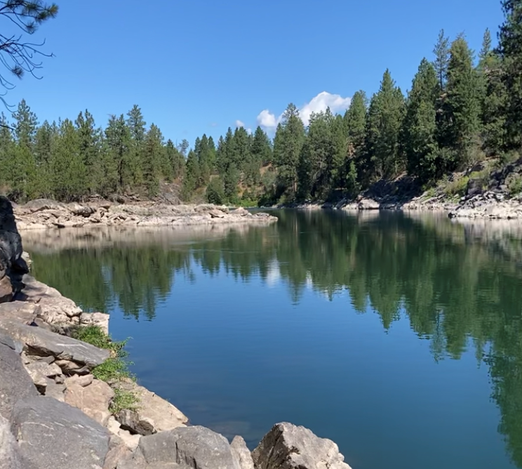
The 500-acre Post Falls Community Forest and adjacent 75-acre Q'emiln Park offer numerous hiking trails with many loop possibilities up to about 6 miles, and also rock climbing, picnicking, and swimming. It is located just over the Washington border, in the city of Post Falls Idaho. There are two trailheads, at Q'emiln Park at lake/river level (entry fee in the summer) and up the hill on Riverview Drive (free all year).

The network of hiking trails run through ravines, along the river, and up and down the hillside, connecting the two trailheads, and all trails are blazed with colored circles and diamonds. Trail maps are posted at both trailheads, and can also be downloaded from the Post Falls Parks web site. There are a few places where the trail borders private property, so be sure to stay on public land by consulting your map. 

If you want a flatter hike, start at Q'emiln Park (although some up and down will still be required). If you start at the Riverview trailhead, you will initially go down, and then have to climb back up the hill at the end of your hike -- but you will be rewarded with views of the valley.

Hike Description Written by
Multiple authors contributed to this report, WTA Community

Post Falls Community Forest and Q'emiln Park

Map & Directions

Trailhead
Co-ordinates: 47.6959, -116.9732 Open in Google Maps

Before You Go

See weather forecast

WTA Pro Tip: Save a copy of our directions before you leave! App-based driving directions aren't always accurate and data connections may be unreliable as you drive to the trailhead.

Getting There

To reach the Q'emiln Park trailhead, take the Spokane Street exit in Post Falls off I-90. Drive south, cross the river, and take the first right. The park will be on your right, and the best entrance for parking is on the right just before the gate.

To reach the Riverview Drive trailhead, take the Spokane Street exit in Post Falls off I-90. Drive south, cross the river, and bear right onto Riverview at the Y intersection. The parking lot is on the right, just after you reach the top of the hill.

Alternate route to Riverview trailhead: Take the Stateline exit off I-90 (near the WA/ID border). Drive south on Bridge Road, which turns east just south of I-90. You'll soon come to a Y intersection -- bear left to Riverview. The parking lot is on the left, just after you reach the top of the hill.

Take Transit:

 
Kootenai County Transit route B stops at Post Falls city hall, which is 0.8 mile from the trailhead in Q'emiln Park. 

More Hike Details

Trailhead

Eastern Washington > Spokane Area/Coeur d'Alene

City of Post Falls, Idaho

You can improve or add to this guidebook entry!

Post Falls Community Forest and Q'emiln Park

6 Trip Reports

Hiked here recently?

Submit a trip report!
 
Trip Reports